
Flight fee
The current tandem flight fee is €155 per participant. A message is an enquiry; current conditions and the pilot's final decision still determine whether we fly.
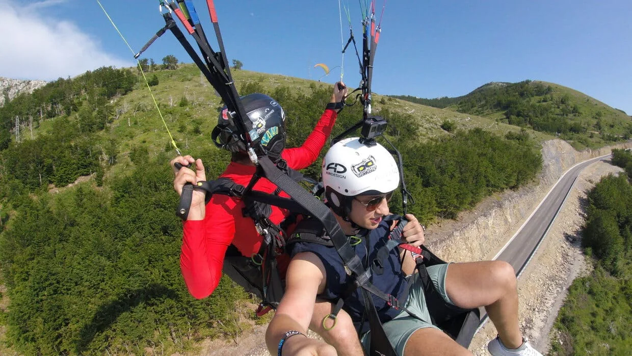
Meet in Kotor, drive up to the 1256 m Lovćen launch, prepare with your pilot, and fly back over the Bay when conditions allow. No previous paragliding experience is needed.
The current tandem flight fee is €155 per participant. A message is an enquiry; current conditions and the pilot's final decision still determine whether we fly.
Pilot GoPro video is optional at €10. After a successful recording, you receive the SD card after the flight or a download link when the files are ready.
Allow up to about 90 minutes for the usual outing; airtime can reach about 25 minutes when lift allows.
Your Kotor flight day
The normal sequence is simple: meet in Kotor, drive to the Lovćen launch, prepare with your pilot, fly when the conditions allow, and land back near the bay shore.
Once the flying day looks workable, we confirm the practical meeting point and timing in Kotor.
Mountain access from bay level to the 1256 m launch usually takes about 40 minutes.
Your pilot fits the harness and helmet, explains the takeoff, and checks the current wind, cloud, visibility and lift.
When lift allows, airtime can reach about 25 minutes. Weaker conditions can make the flight shorter.
The normal route finishes near the bay shore around Small Beach. The pilot can change the landing plan if conditions require it.
The current tandem flight fee is €155 per participant. A message starts the enquiry; the flight is confirmed only when the current weather, pilot availability and practical conditions line up.
Yes. Pilot GoPro video is optional at €10. After a successful recording, you receive the SD card after the flight or a download link when the files are ready.
No. Most tandem passengers are first-time flyers. Your pilot controls the wing and explains the few things you need to do for takeoff and landing.
Allow up to about 90 minutes for the usual cycle from meeting and mountain access to preparation, flight and landing. Airtime can reach about 25 minutes when lift allows.
We confirm the practical meeting point in Kotor when the day looks workable. Takeoff is from the Lovćen slope at 1256 m. The normal route finishes near the bay shore around Small Beach, although the pilot can change the landing plan if conditions require it.
For adults, the usual working range on this high Kotor route is about 50–100 kg. If you are around 100 kg or more, tell us your approximate weight in the first message. Equipment, weather, mobility and the pilot's final assessment still decide suitability.
Age alone does not decide suitability. For children, body size, suitable equipment, conditions and guardian consent all matter. For older adults, mobility and comfort during takeoff and landing matter more than the number itself. Ask the team before planning the day.
Wear secure closed shoes and comfortable seasonal clothing. A light wind layer is useful because the launch can feel cooler than Kotor town. Sunglasses can help; loose or unsecured items should stay off the takeoff run.
You can tell us your preferred day and time window, but we do not promise an exact slot before checking the real conditions. Wind, cloud, visibility, lift and launch or landing conditions can move the timing.
We do not force a takeoff. If a short wait is useful, the pilot may wait for the conditions to improve. If the safe window does not develop, we come back down and agree the next practical step with you.
The current Kotor tandem flight fee is €155 per participant.
Pilot GoPro video is optional at €10. After a successful recording, you receive the SD card after the flight or a download link when the files are ready.
The flight itself comes first. Video, exact airtime and the final route all depend on the real flying day.
You fly together with a tandem pilot. The pilot controls the paraglider from takeoff to landing.
Before takeoff, we fit the harness and helmet and explain the start in simple terms. When your pilot gives the command, you move forward confidently for a few seconds. Once the wing is flying, you sit back into the harness and enjoy the view.
Before landing, your pilot tells you when to come upright and what to do with your legs. The instructions are short and practical; you do not need previous paragliding training.
For adults, the usual working range on this high Kotor route is about 50–100 kg.
Being inside that range is not automatic clearance. Equipment fit, mobility, wind, lift, takeoff and landing conditions still matter. If you are around 100 kg or more, tell us your approximate weight in the first message so the pilot can assess the current route and equipment properly.
Basic mobility is important. You need to stand steadily, follow instructions, move forward during takeoff and take a few steps at landing when the pilot asks.
Children can only be considered when suitable equipment, body size, weather and guardian consent all line up. For older adults, mobility and comfort during takeoff and landing matter more than age alone.
Wear secure closed shoes such as trainers or light hiking shoes.
Dress for the season, but remember that the 1256 m launch can feel noticeably cooler than Kotor town. A light wind layer is useful even on warm days. Sunglasses can help in bright conditions.
Keep loose items secure. If you want to use a phone or another camera, ask your pilot before takeoff; nothing should interfere with the launch, harness or landing.
Come sober and ready to follow the pilot’s instructions. Avoid arriving immediately after a very heavy meal.
Kotor is a high route above an enclosed Bay. Wind direction and strength, cloud, precipitation, visibility and thermal lift all matter.
On many suitable days, the useful flying period is from late morning to late afternoon, often roughly 11:00–17:00. That is a weather window, not a schedule. A calm waterfront does not automatically mean the launch is ready to fly.
When lift is good, airtime can reach about 25 minutes. Weaker lift can shorten the flight even when takeoff and landing conditions are safe.
The final go/no-go decision belongs to the tandem pilot at the launch.
If conditions are temporarily unsuitable and a short wait makes sense, we may wait. If the safe window does not develop, we do not force the flight; we come back down and agree the next practical step with you.
That uncertainty is part of real paragliding, and we would rather explain it clearly than promise a fixed ride the weather cannot support.
If Kotor is the route you want, send us:
You can contact us in English or Russian. A message starts the enquiry; the actual flying plan is confirmed only when the current conditions and practical details line up.
Basis: current Kotor route facts, suitability notes and the 2026-10-07 local-pilot-team operational layer.
Weather, access, pilot availability, equipment fit and launch or landing conditions can change the timing, route or whether we fly. A flight enquiry is not automatic confirmation.
Kotor flight enquiry
Tell us your preferred day or date range and how many people want to fly. If you are around 100 kg or more, include your approximate weight. We will reply with the practical details; final confirmation still depends on the current flying conditions.
Before you ask about a flight