Launch
Launch images support the 1256 m Lovcen-slope start.
Use this gallery to read the Kotor route in order: high Lovcen launch, enclosed Bay, fortress and Old Town, seated passenger posture and lower approach.
Launch images support the 1256 m Lovcen-slope start.
Route images make the Bay, St John Fortress and Old Town legible.
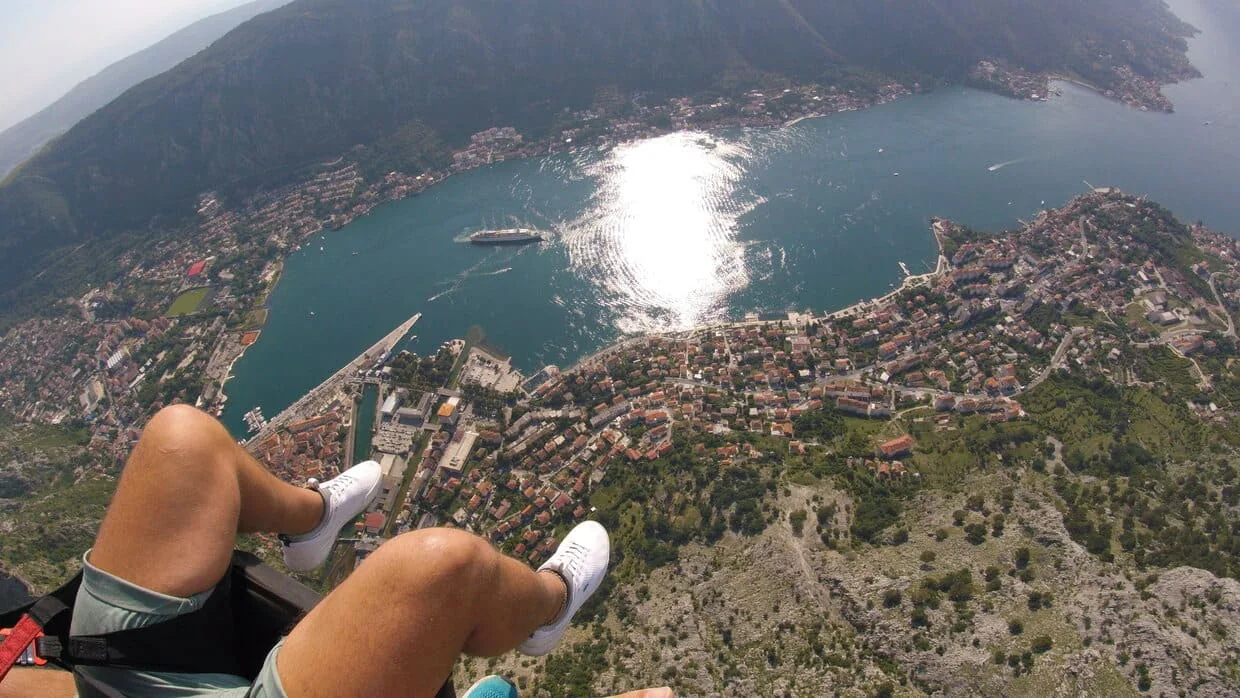
Participant images show a seated, pilot-led tandem demonstration rather than a staged action shot.
Use the images below to read the Kotor tandem demonstration route before you check practical details. Each section matches one part of the flight, from launch and Bay shape to the lower Old Town approach. The gallery is route proof, not a guarantee that the same light, cloud base or landmark visibility will appear on a chosen date.
Look for the mountain slope, the altitude and the Bay opening below. This is the height that sets Kotor apart from lower coastal starts.
Wide Bay images show how water, mountain walls and open air combine into a scene that would be hard to mistake for somewhere else on the coast.
Look for images where the fortress, the Old Town or their relationship to the Bay is visible. These show the lower part of the route — not a promise of identical visibility on every date.
Participant images show the real character of the demonstration: seated in the harness, guided by the pilot, calm rather than staged for drama.
Lower approach images show the practical end of the route near the bay shore and Old Town context. They help with orientation, but exact landing details still depend on the day, access and operating decisions.
Spring and autumn can carry richer color. Summer is often lighter and easier for clothing. Winter can be cooler, especially at launch. These variations help set honest expectations, not one ideal look for every date.
Look for the route order: high Lovcen launch, enclosed Bay, fortress and Old Town, not only general scenery.
No. Images show what the Kotor route can look like; weather, light, cloud, visibility and exact operating decisions vary by day.
They show lower approach and bay-shore context. Exact landing details, access and visibility can change with the day's operating decisions.
Continue to the practical Kotor page for timing, flight fee, participant suitability and weather details if the Bay route looks right.
Basis: current gallery asset set, page captions, Kotor route framing and bounded visual-proof wording.
Image permissions, caption precision, landing context and access assumptions should be reviewed when the visual set or operation changes.
After the gallery
The practical page explains timing, fee, participant fit, clothing and weather checks before any date question.
Before you reach out